The Town of Lyndon, Vermont, is situated at the confluence of the multiple branches of the Passumpsic River and Millers Run. Significant development has occurred in the floodplain, both reducing floodplain function and increasing risk to infrastructure. Today, flooding occurs routinely in Lyndon, covering major intersections and roadways, and, in the worst cases, damaging homes and businesses. The community hired water resource engineers SLR Consulting to examine possible solutions to reduce flood damage and develop flood mitigation strategies. Whiteout Solutions was contracted by SLR Consulting to collect topobathymetric data to support the hydraulic river model used to test mitigation solutions.
Objective: Generate high-resolution topographic and bathymetric maps of the river corridor and floodplain in Lyndon, Vermont. SLR Consulting is using the data to a develop high-resolution 2D hydraulic model, to test and validate the effectiveness of various flood mitigation strategies.
Challenge: High-resolution bathymetric data is crucial for developing accurate models, but most engineering firms rely on traditional wet surveys, remote-controlled boats with sonar, or publicly available bathymetric data. These methods can create dangerous or high-risk survey conditions, require more resources and longer project time frames, and typically result in lower-resolution models with less confidence in the final designs. Publicly available data typically does not extend below the water surface.
“To best help communities at risk of flood damage, topobathy data in our hydraulic models help us understand flooding and evaluate solutions to reduce flood risk. The topobathy LiDAR used here allows us to create hydraulic models that provide significant information to our clients.””

Project Specs:
Client: SLR Consulting / Town of Lyndon
Collection Services: UAS Topobathy & Topographic LiDAR, Processing & Analysis
Processing and Analysis: ASPRS Classified Point Cloud, Digital Terrain Model, Digital Surface Model


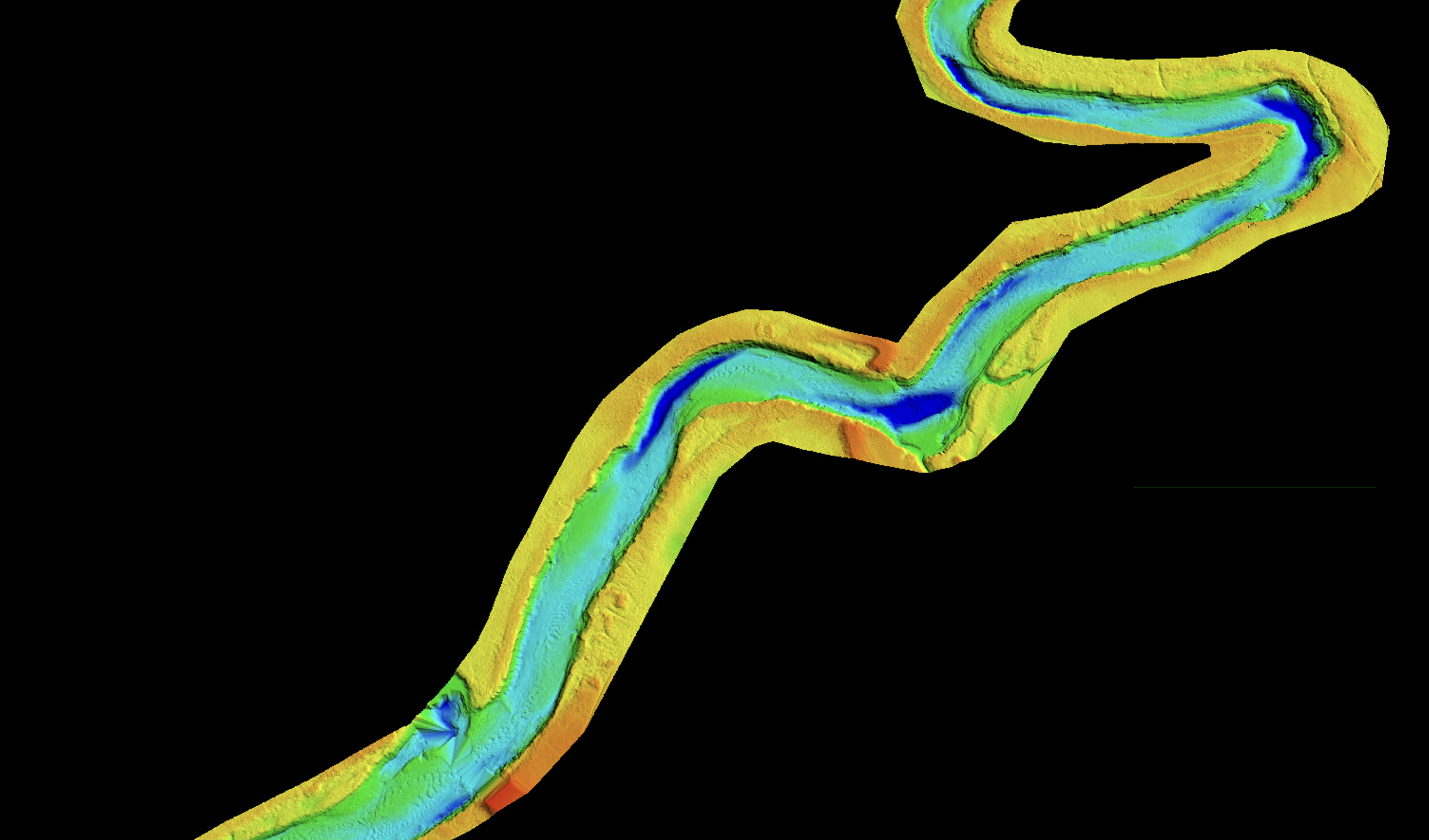
Hydro electric dam cross section – The topobathymetric LiDAR allowed us to not only survey the river bottom but also infrastructure like the Vail Hydro Station where we were able to see the impoundment behind the dam and the spillway.
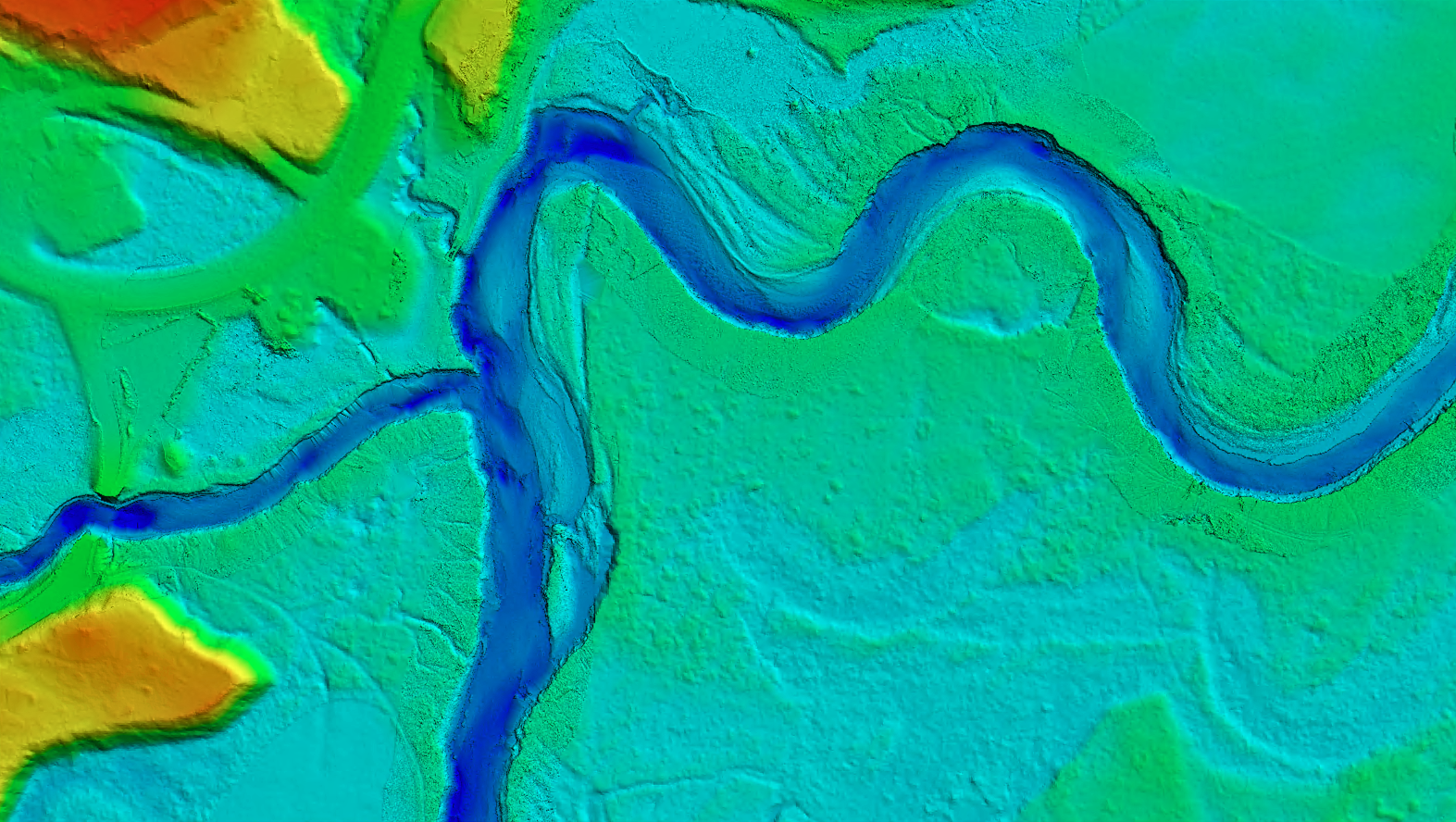
Confluence of Millers Run & Passumpsic River
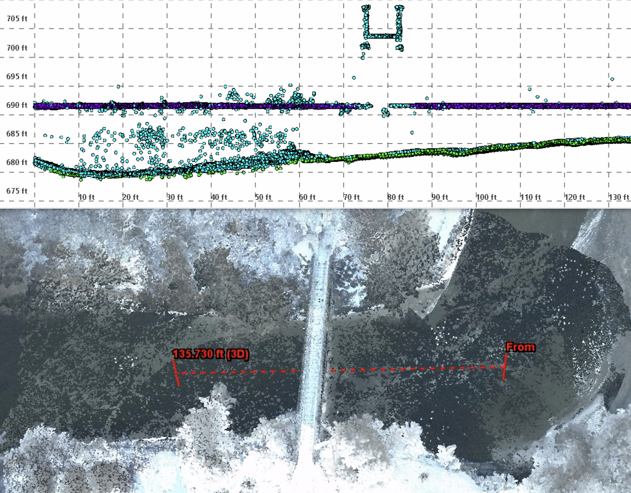
Cross section of a foot bridge over the Passumpsic River
Meander of the Passumpsic – Digital Terrain Model

Results:
- LiDAR collected an average of 200 elevation points per square meter, creating very high-resolution topobathy datasets with clearly defined fluvial geomorphology.
- The dataset represented 100% of the 6-mile river corridor, giving partners the ability to produce highly accurate 2D models.
- Data was delivered through geoSAP, allowing SLR to view large and complex topobathy LiDAR point clouds.
Key Takeaways: Hydraulic models of riverine and floodplains are less accurate without topobathy LiDAR. UAS platforms allows for highly targeted aerial surveys of hard-to-reach areas. Higher accuracy hydraulic models contribute to better risk assessment and management, helping to protect lives, property, and infrastructure from future flood events.
Explore Lyndon Project Data
geoSAP is a data delivery application making it easy to view, share and download large geospatial datasets.