Targeted High Resolution, High Accuracy Topobathymetric LiDAR
Monitoring change just below the surface with Helicopter based topobathy LiDAR
Under the right conditions, topobathymetric LiDAR can be one of the most powerful tools for analyzing and monitoring hydrography and topographic surfaces. Using helicopter to carry these heavier payloads have provided the right solution for larger scale, hard to reach topobathymetric LiDAR surveys to be conducted.
Whiteout Solutions is one of the only geospatial technology companies offering helicopter based topobathy LiDAR services. Our solutions is capable of mapping up to 15M below the water surface and 2.5x below secchi depth. In the right conditions, we’re able to collect over 1,000 acres of point cloud data per day with 200 points per square meter and up to 2cm of vertical accuracy.
Benefits of Topobathy LiDAR :
- Identify areas experiencing coastal erosion and assess the extent of the damage
- Measure the effectiveness of sediment restoration efforts and identify areas that need further attention
- Design and plan engineering projects with highly accurate data, reducing the risk of errors and delays
- Monitor changes in the environment over time, allowing for proactive management of coastal erosion and sediment restoration efforts
- Riverine Corridor Mapping – mapping the effects of storms and providing enhanced derived raster data (DTM/DSM) for HEC-RAS engineering and year over year change monitoring.
Utilizing our extensive knowledge of aerial surveying, Whiteout Solutions can deliver valuable insights into both the terrestrial and aquatic environments. Whiteout Solutions has worked closely with public, non-profit and private organizations to bring complex and expansive projects to fruition, we are always a ready and willing partner.
Topobathy LiDAR Use Cases:
- Coastline Engineering and Restoration Mapping
- Floodplain Mapping
- Hydro-Archaeological-Surveying
- River Corridor Mapping
- Dam & Reservoir Surveys
- Port & Harbor Management
- Surveying for Hydraulic Engineering
- Bridge and Aquatic Infrastructure Surveys
- Dredging and Excavation
What you can see with Topobathy LiDAR:
- Meanders, Bars, and Other Fluvial Features
- Scouring, Erosion & Channel Geomorphology
- Sediment Impoundment & Transport
- Sub Aquatic Vegetation
- Reefs
- Underwater infrastructure, including pipelines, bridge piers, drainage culverts and more.
- Water Surface and Wave Structure ands Patterns
- Other submerged objects

Ela-Dam-Removal-RGB-pointcloud

Ela-Dam-digital-terrain-model-topobathy

geoSAProtating
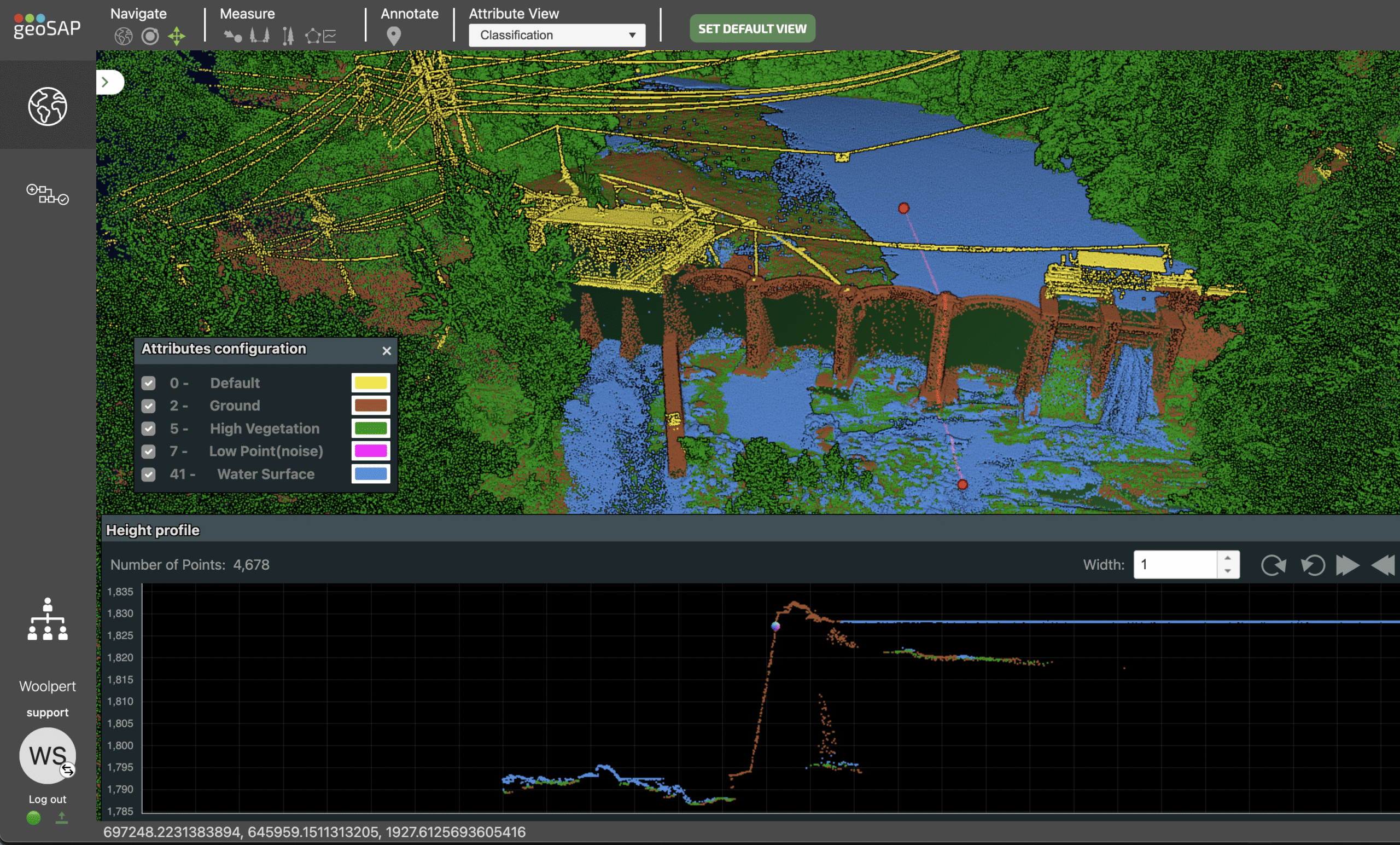
Ela-Dam-Cross-Section-topobathy

HousatonicCrossSEction1_Prj2
Riverine returns all the way to the bottom with Bathymetric LiDAR data acquired by Whiteout and processed with geoSAP Fusion


BlackHelicopter
Topo and Bathy LiDAR mounted on Helicopter for geospatial acquisition

HeloVuxbathy
Hyperspectral, Topo and Bathy LiDAR Sensors
