Given the sites history and significant number of stakeholders including tribal groups, multiple local municipalities, state and federal agencies and non-profits conservation groups the removal project is very complex.
Objective: In the fall of 2024, Whiteout Solutions was contracted by Woolpert’s eTrac division and McMillen, Inc establish a high-resolution elevation model of the Ela Dam as well as upstream and downstream extents. This data will be used both in the preliminary removal design and hydraulic modeling but also establishes a baseline dataset for post-removal reference.
Challenge: Woolpert has extensive experience in vessel and fixed wing aircraft-based bathymetry surveys but given the varying water depths, the narrow and meandering nature of this river corridor, the standard acquisition methods were not appropriate. With a need to analyze the impoundment behind the Ela Dam and the downstream floodplains that could be most impacted during the removal, it was vital to conduct a survey that covered both the river channel and upland buffer.

Project Specs:
Client: Woolpert / McMillen Inc.
Collection Services: UAS Topobathy & Topographic LiDAR, Processing & Analysis
Processing and Analysis: ASPRS Classified Point Cloud, Digital Terrain Model, Digital Surface Model, Elevation Contours


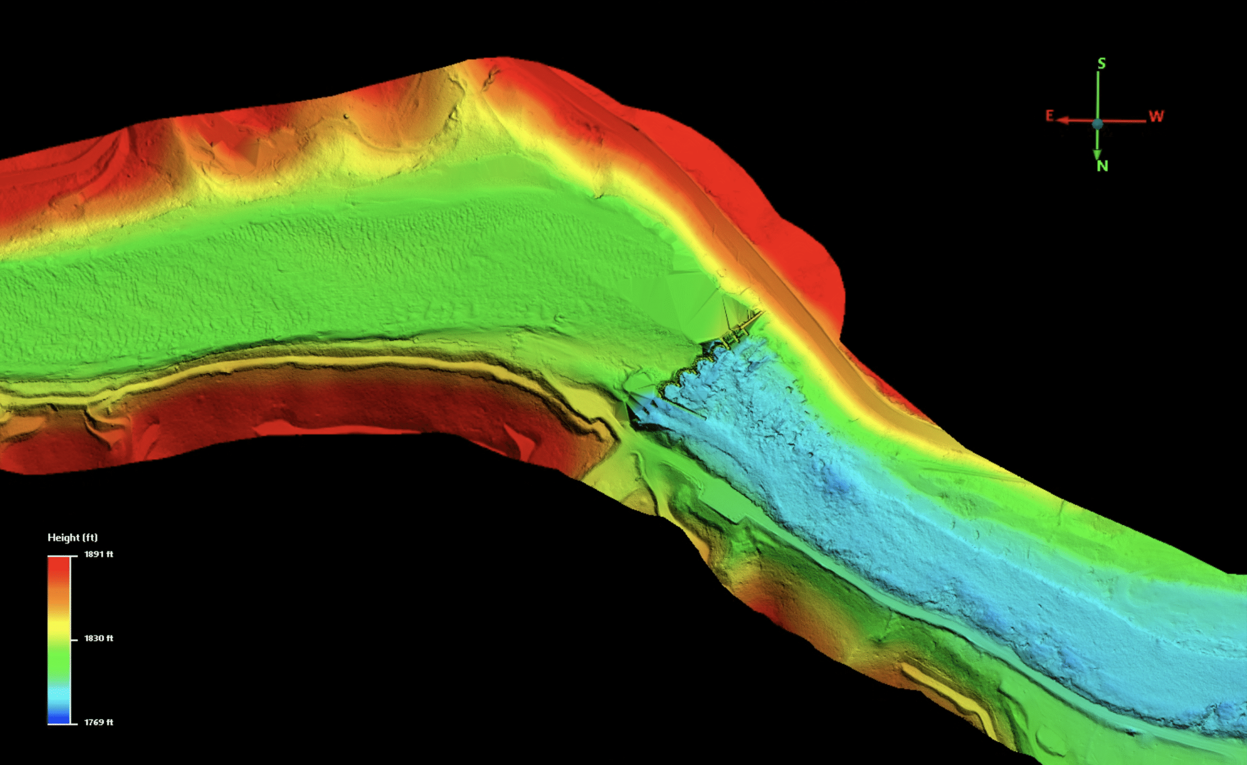
Digital Terrain Model of the Ela Dam – The topobathymetric LiDAR allowed us to not only survey the river bottom but also infrastructure like the Ela Dam planned for removal.

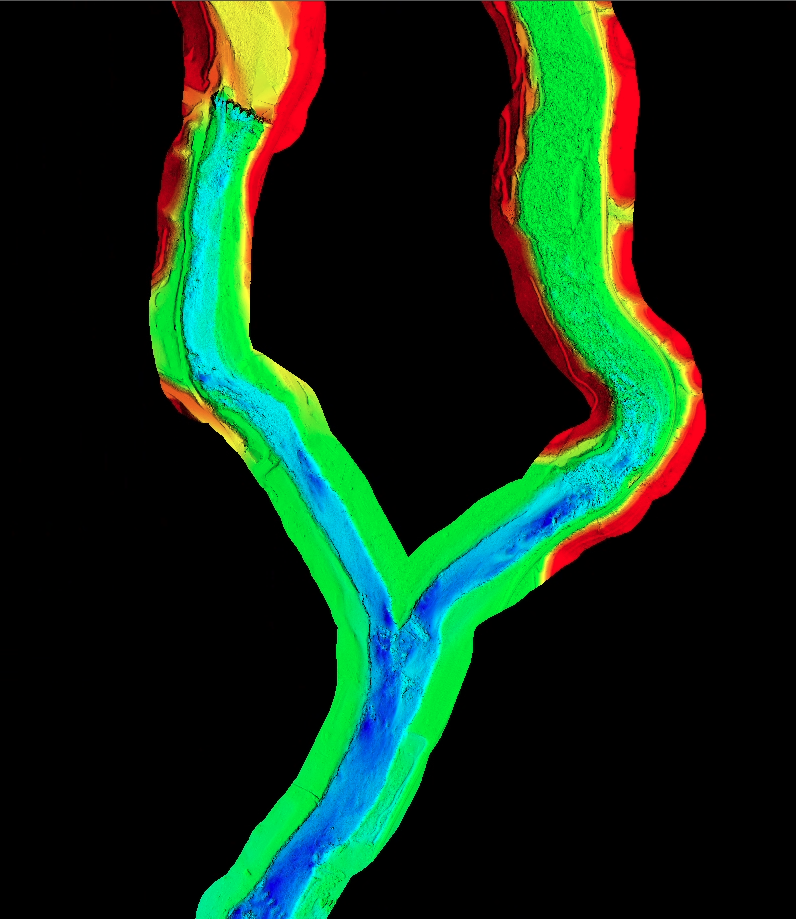
Solution: Whiteout Solutions’ helicopter based topobathy LiDAR solution provides an efficient method for establishing the high resolutions bathymetry data, especially in the hard-to-reach land/water interface and through meandering river corridors such as the Oconaluftee River. Whiteout Solutions mounted its Riegl 840 GL topobathy LiDAR to a helicopter to fly the 13 miles survey extent, targeting both the river bottom river banks.
Results:
- Whiteout Solutions was able to mobilize to conduct the mission before a major storm system entered the region which would have likely generated significant turbidity and delaying the survey until the sediment settled.
- The team worked closely with Woolpert to develop a ground control plan that their survey unit established throughout the survey area. This allowed the Whiteout Solutions team to focus their efforts on the remote sensing.
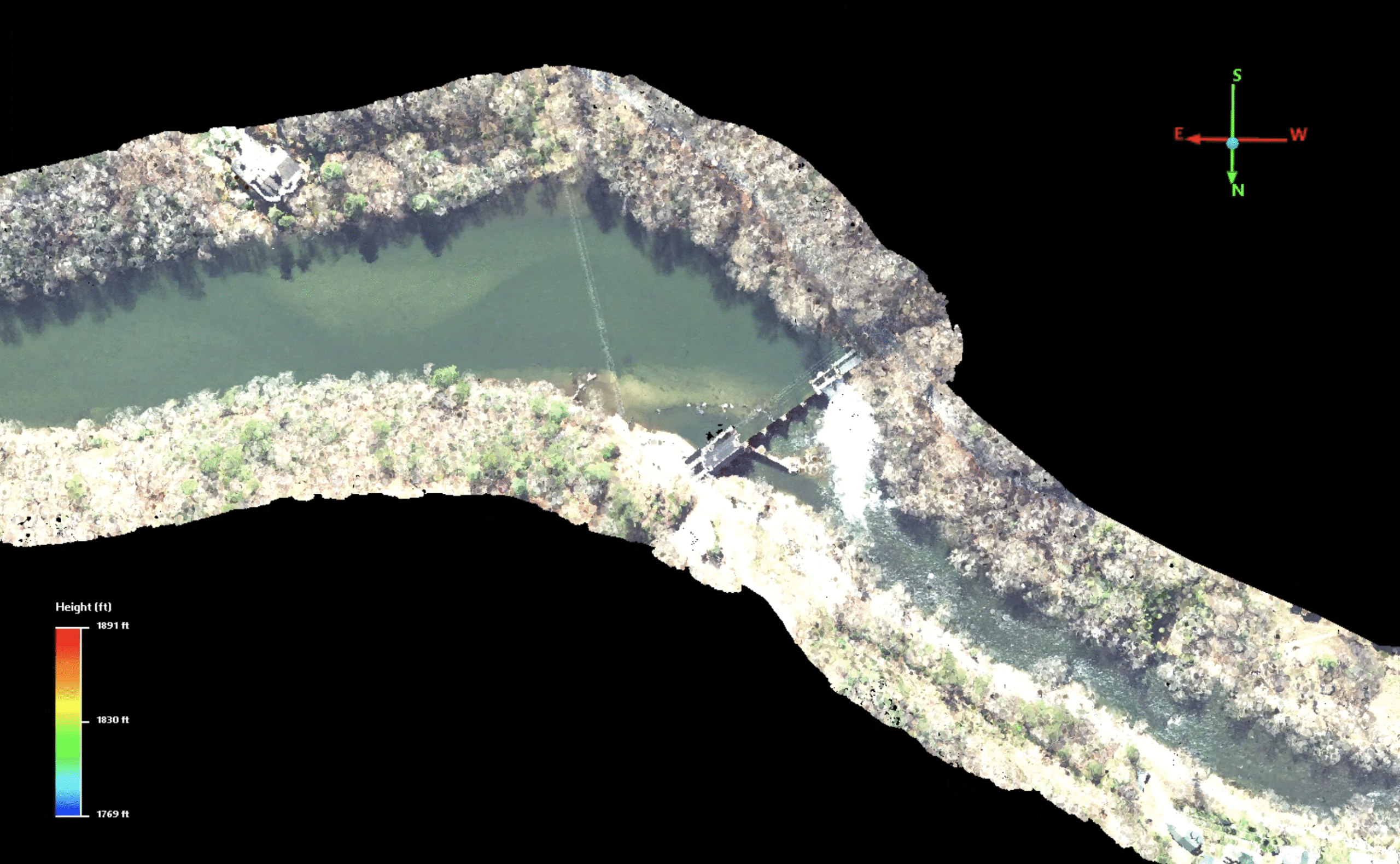
- The combination of the clean water, slightly overcast skies and refined sensor settings on the 840GL lidar system, the team was able to successfully survey the entire 13-mile extent with excellent laser penetration through the water.
- The resulting dataset had an average vertical accuracy of 1.31cm at 50-100 points per square meter.
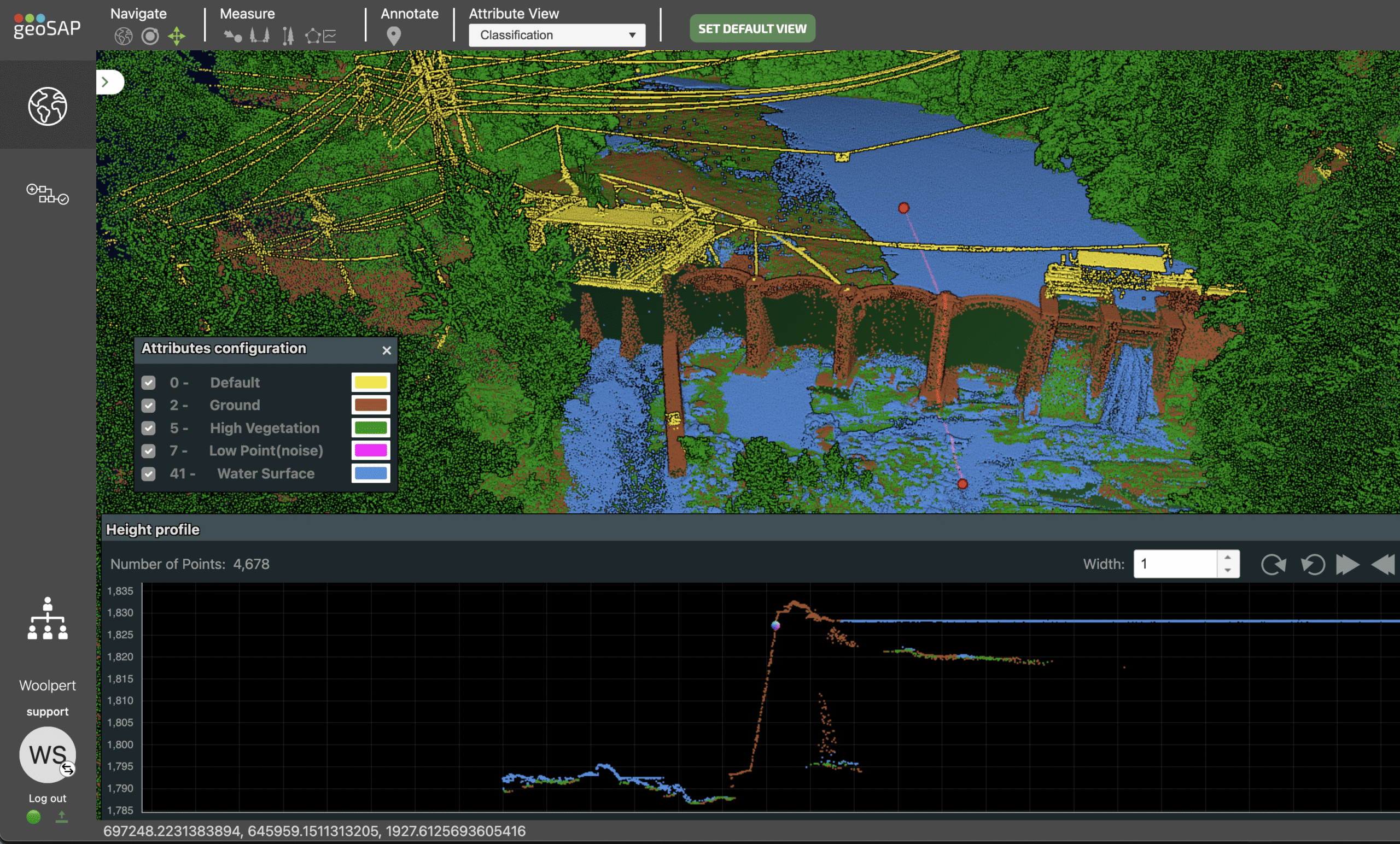
- All data was delivered through geoSAP allowing key stakeholders to view, share and download datasets collected through the project.