“The multi-purpose geospatial dataset created for NVDA will allow communities and planners to see the trails and adjacent village centers through the eyes of a trail user, givings them a better sense of what is need to broaden the economic impact of the trails.”
Northeastern Vermont Development Association (NVDA) hired Whiteout Solutions in the fall of 2021 to collect aerial LiDAR for the 37 miles of Lamoille Valley Rail Trail (LVRT) between St. Johnsbury and Hardwick. The vision for the unplanned section of rail trail is to strategically place trailheads in close proximity to the village centers of St. Johnsbury, Danville, Greensboro Bend and Hardwick. In addition to aerial LiDAR collection, Whiteout Solutions collected terrestrial LiDAR from the proposed LVRT trail head to the town centers. This multi-purpose dataset will be used for trail expansion planning, recreation resource management of existing trail, visitor marketing, and more.
Objective: To collect a contiguous LiDAR point cloud of both the existing and new segments of the Lamoille Valley Rail Trail. Provide Digital Terrain Models of the trail surfaces, depicting slope and elevations of the trail surface. Also, provide elevation contours to assist in understanding trail grade and potential resurfacing required. Colorized point clouds will be generated so that real world 3D models of the trail can be visualized.
Challenge: The area to be collected is 37 miles of linear rail trail and 31 miles of roadways and corridors totaling 68 miles of collection area. The rail trail area must be covered with an all terrain vehicle (ATV) in order for us to keep eyes on the quad-copter flying overhead. Permits were required for ATVs on trail and vehicles needed numerous gas refuels. Coordinating the public (trail visitors and land owners) and managing their interest while keeping the drone in the air can be a juggle and although we are clearly marked with safety vests and vehicle signage, questions are inevitable. Additionally, there were numerous battery changes along the way with minimal charging opportunities. A good support plan was needed.
Project Specs:
Client: Northeastern Vermont Development Association (NVDA)
Collection Services: Aerial and Terrestrial LiDAR
Processing and Analysis: DTM, DSM, Contours and Classified Point Cloud

Beneath the Canopy – With much of the Lamoille Valley Rail Trail running through very rural hard to reach and heavily canopied areas, Northeastern Vermont Development Association and it’s partners needed a model that gave them a clear understanding of potential challenges and existing conditions of the proposed trail.
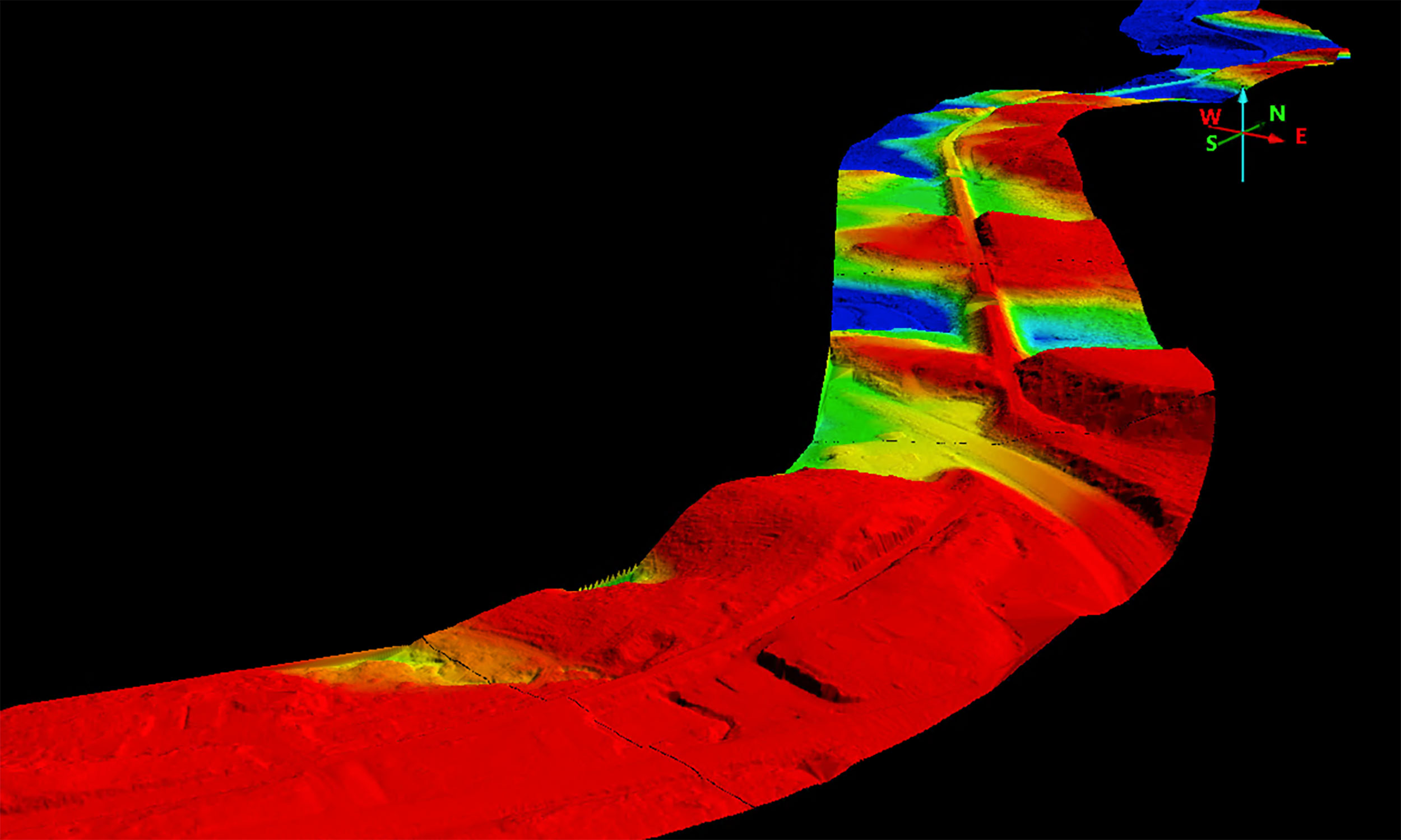
Digital Terrain Model of Walden Section
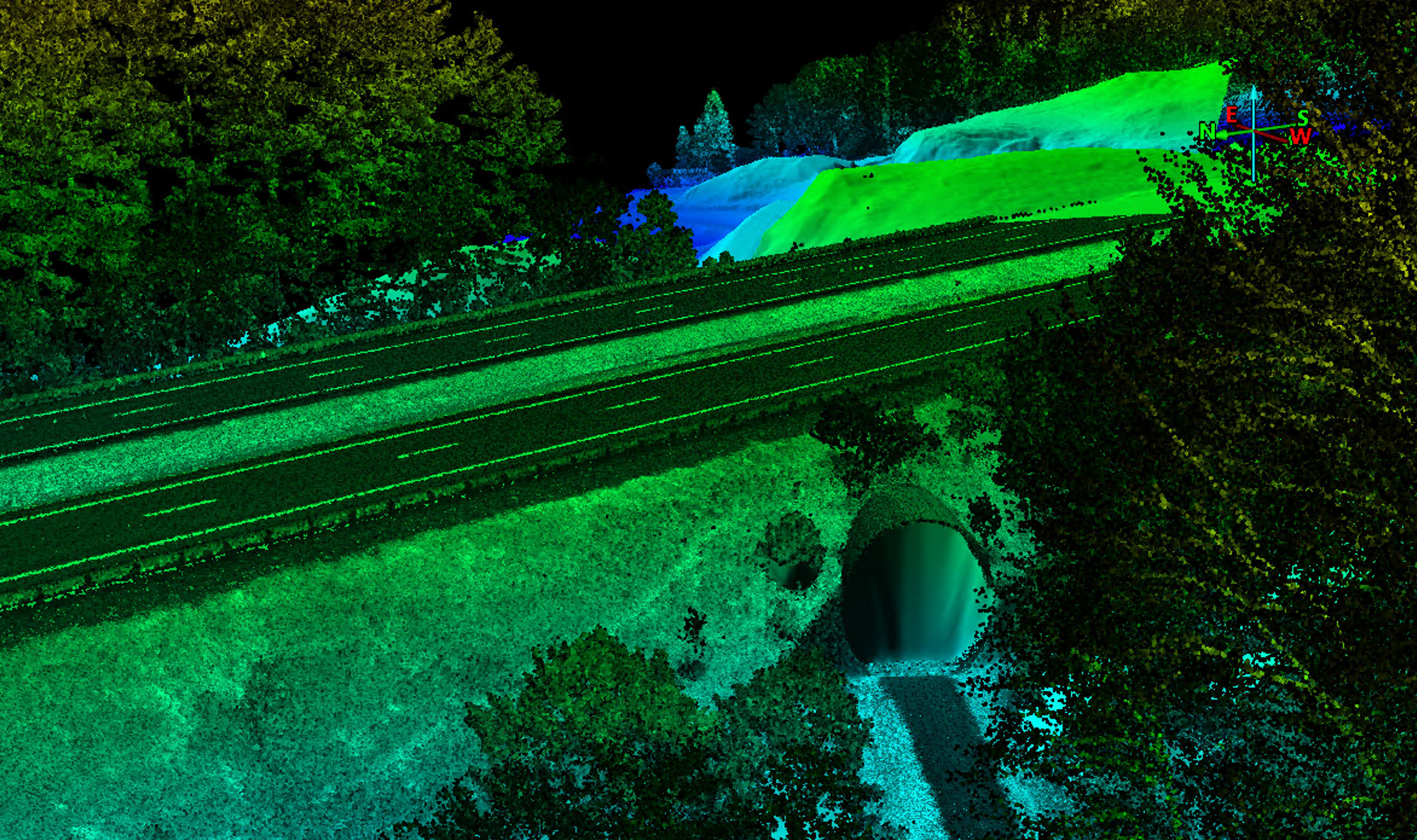
Trail through a tunnel In St.Johnsbury
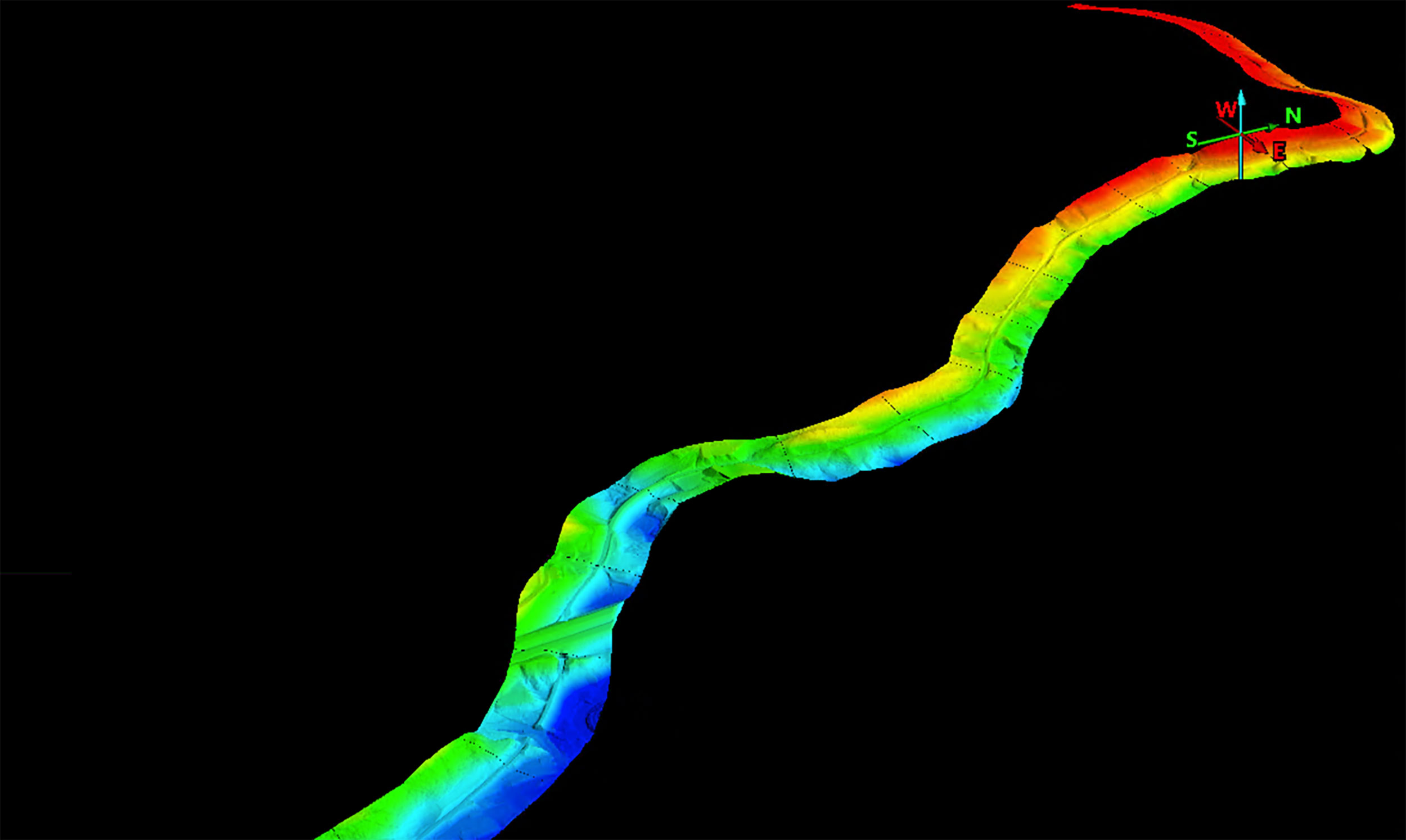
Digital Terrain Model of St. Johnsbury Section
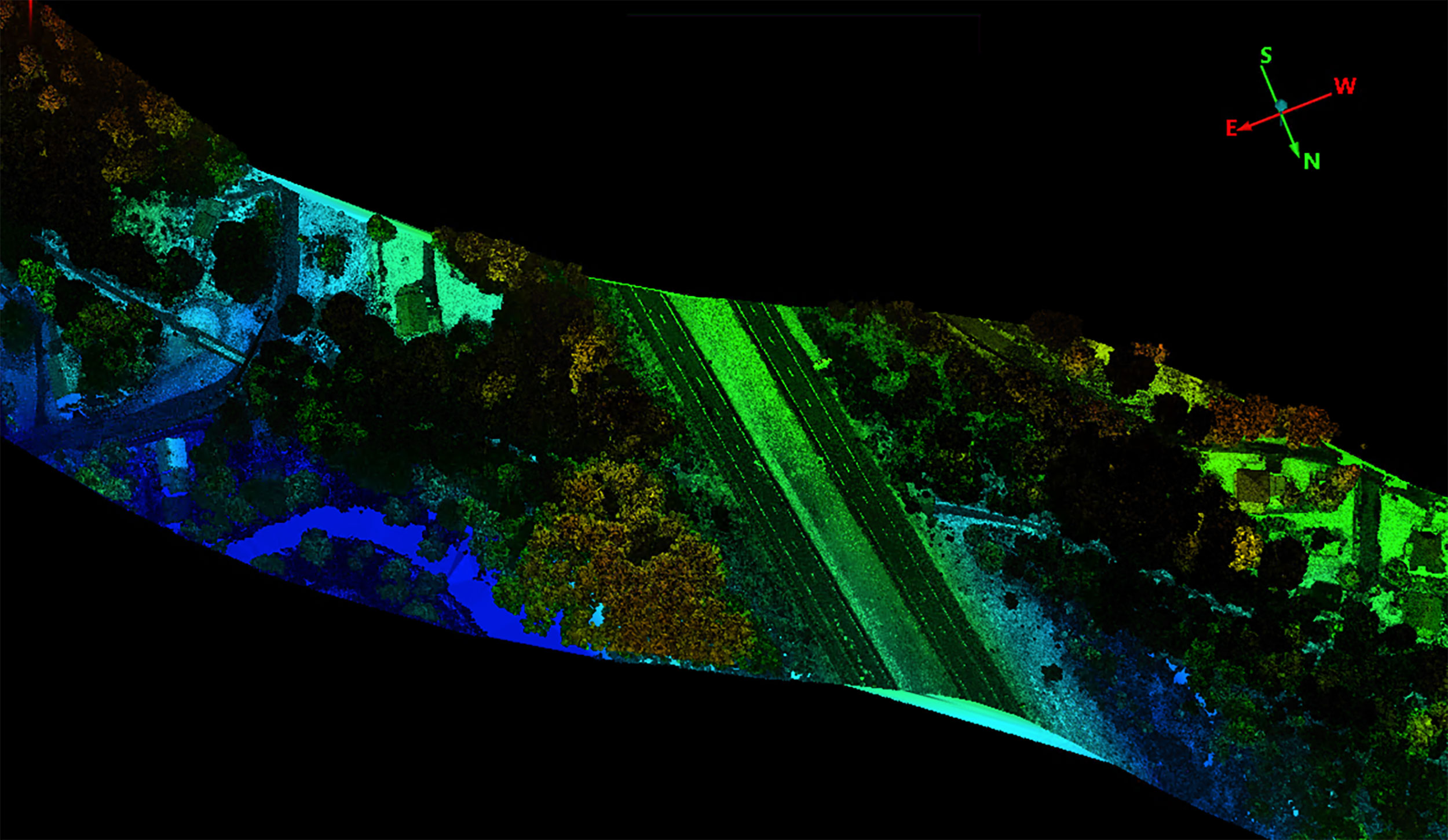
Top view of complex trail section

Solution: Whiteout Solutions collected both aerial and terrestrial LiDAR data necessary to analyze and visualize the length of the Caledonia county section of the LVRT. Processing of these outputs produce:
- Classified point clouds
- Digital Terrain Models(DTM)
- Digital Surface Models(DSM)
- Elevation Contours
Results:
- Up front project planning to map out collection routes and resources was critical to project success
- Proved that elevation data collected could dramatically improve the planning for the trail assuring slopes and ranges meet project requirements
- PointCloud rendering and fly through of rail trail is a powerful means of visualization
- Large file access through GeoSAP provided easy data access for the many project constituents needing to work with the data sets